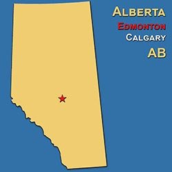
 Alberta is a province of striking contrasts, where the Rocky Mountains give way to foothills, open prairie, parkland, and vast northern forests. Its western peaks were formed as layers of ancient sedimentary rock were compressed and thrust upward, then sculpted by glaciers into sharp ridges, broad valleys, and lake basins. Farther east, the badlands reveal a different chapter of Earth's history, with exposed layers of sandstone and mudstone containing remarkable dinosaur fossils. Much of the province rests over the Western Canada Sedimentary Basin, whose buried deposits help explain Alberta's importance in oil and natural gas production. Rivers such as the Athabasca, Peace, and North Saskatchewan connect mountain headwaters with agricultural country and the boreal north.
Alberta's climate is generally continental, with large seasonal temperature changes, relatively dry air, and considerable sunshine. Winters can be severely cold, although warm Chinook winds sometimes bring sudden thaws to communities east of the Rockies, particularly in the south. Summers are often warm, with thunderstorms crossing the plains and cooler conditions at higher elevations. Southern grasslands receive less moisture than many mountain and northern areas, making drought and water management important concerns. The seasons shape both work and recreation, from planting and harvest to skiing, hiking, and the brief but lively summer season in northern communities.
Long before Alberta became a province in 1905, its landscapes supported diverse Indigenous nations, including the Blackfoot Confederacy, Cree, Dene, Tsuut'ina, and Nakoda peoples, as well as the developing communities of the Métis Nation. Fur trading, treaties, railway construction, ranching, and agricultural settlement transformed the region, often through policies that displaced Indigenous peoples and restricted their ways of life. Later petroleum development helped turn Calgary and Edmonton into major urban centres. Alberta's culture brings together rodeo and ranching traditions, Indigenous arts and languages, Ukrainian and other immigrant heritages, and increasingly diverse city neighbourhoods. Its identity is expressed as readily through festivals, theatre, and contemporary music as through grain elevators, cowboy imagery, and mountain trails.
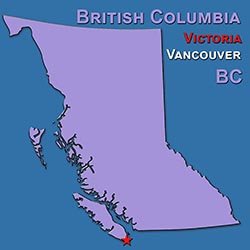 British Columbia stretches from the Pacific Ocean to the Rocky Mountains, encompassing offshore islands, deeply indented coastlines, forested mountain ranges, interior plateaus, and broad river valleys. Its geology records the assembly of ancient crustal fragments along the continent's western edge, together with volcanic activity, mountain building, and repeated glaciation. The result is a landscape of fjords, steep coastal slopes, glacier-fed rivers, and rugged peaks, with the Fraser River forming one of its great geographic corridors. Vancouver Island and Haida Gwaii have distinctive landscapes and ecosystems, while the interior includes grasslands, fertile valleys, and extensive northern forests. British Columbia's scenery is inseparable from the movement of water, whether in Pacific surf, salmon-bearing streams, or snowmelt flowing down from the mountains.
The province has some of Canada's greatest climatic variety. Much of the coast experiences relatively mild, wet winters and ocean-moderated summers, supporting temperate rainforests, although sheltered areas around southeastern Vancouver Island are considerably drier. Beyond the coastal mountains, rain shadows create dry valleys and grasslands, and parts of the southern interior have hot summers suitable for orchards and vineyards. Northern communities and high mountain areas face colder winters, shorter growing seasons, and deeper or more persistent snow. These differences allow coastal gardening, interior agriculture, and alpine recreation to coexist within one province, while wildfire, drought, flooding, and changing snowpack affect different regions in different ways.
British Columbia is home to many distinct Indigenous nations, including Haida, Coast Salish, Nuu-chah-nulth, Kwakwaka'wakw, Secwépemc, and numerous others whose territories, languages, and artistic traditions remain central to the province. European maritime trade, the fur trade, and nineteenth-century gold rushes brought major upheaval, followed by British Columbia's entry into Confederation in 1871 and the completion of a transcontinental railway connection. Forestry, fishing, mining, and Pacific commerce shaped its communities, while immigration from Asia and around the world enriched its cultural life. Today, Indigenous carving and weaving, vibrant food traditions, film production, music, and outdoor recreation all contribute to its character. Vancouver's international outlook, Victoria's historic streets, and the distinct identities of coastal and interior towns reveal a province with many different ways of belonging.
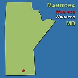 Manitoba lies where Canada's prairie interior meets the Canadian Shield and the shores of Hudson Bay. Southern farming districts include level plains and fertile soils left by ancient glacial Lake Agassiz, while eastern and northern regions reveal much older bedrock, forest, and countless lakes. Lake Winnipeg, Lake Manitoba, and Lake Winnipegosis are major features of a landscape shaped by ice, meltwater, and changing drainage systems. Farther north, the Hudson Bay Lowlands contain extensive wetlands, and forest eventually gives way to tundra along the coast. The Red and Assiniboine rivers meet at Winnipeg, linking the province's physical geography with its long history as a gathering place and transportation crossroads.
Manitoba has a strongly continental climate, especially in the south, with warm or hot summers and long, very cold winters. Open terrain allows Arctic air to sweep southward, and winter winds can make exposed conditions particularly harsh. Summer brings thunderstorms, long daylight hours, and productive growing conditions, although rainfall varies and both drought and flooding can affect agriculture. The north has shorter summers and a colder climate influenced by latitude and Hudson Bay, whose seasonal ice affects nearby coastal conditions. Around Churchill, the annual freezing and thawing of the bay helps shape the movements of polar bears and the seasonal presence of beluga whales.
First Nations, including Anishinaabe, Cree, Dakota, and Dene peoples, have deep relationships with Manitoba's lands and waterways. The fur trade fostered the growth of Métis communities, and the Red River Resistance, led by Louis Riel, was central to Manitoba's creation as a province in 1870. Subsequent railway expansion and agricultural settlement brought newcomers while Indigenous and Métis communities faced dispossession and broken promises. Manitoba's cultural life reflects those histories through Métis fiddling and dance, First Nations artistic traditions, the francophone community of Saint-Boniface, and the contributions of many immigrant communities. Winnipeg is known for music, theatre, dance, and festivals, while rural and northern communities maintain their own strong connections to language, family, and place.
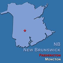 New Brunswick is a Maritime province of forested uplands, river valleys, and contrasting coastlines, bordered by the Bay of Fundy to the south and the Gulf of St. Lawrence to the east. Its rocks preserve a complex history of ancient seas, volcanic activity, and the building and erosion of the Appalachian mountain system. Glaciers later reshaped the terrain, leaving lakes, rounded hills, and deposits that support farming in suitable valleys. The Saint John River, also known by its Wolastoqey name, Wolastoq, is one of the province's defining waterways. Along Fundy, exceptionally large tides expose broad intertidal areas and work continually on coastal cliffs, while the eastern shore offers sandy beaches, dunes, and sheltered fishing harbours.
New Brunswick's climate combines continental and maritime influences rather than following a single coastal pattern. Inland districts generally experience colder winters and warmer summers than areas moderated by the sea, while northern uplands often receive substantial snowfall. The Fundy coast can be cool and foggy in summer, whereas sheltered eastern beaches enjoy warmer seasonal waters. Autumn brings colourful hardwood forests, and winter supports skiing, snowshoeing, and snowmobiling across much of the province. Forest conditions, river flows, coastal storms, and spring snowmelt all influence daily life, making the relationships between land, water, and weather especially visible.
The province is part of the homelands of the Wolastoqiyik, Mi'kmaq, and Peskotomuhkati peoples, whose histories extend far beyond the colonial period. French settlement established enduring Acadian communities, while the forced deportations beginning in 1755 profoundly disrupted Acadian life. Loyalist migration after the American Revolution helped lead to New Brunswick's establishment as a separate colony in 1784, and it became one of Canada's four founding provinces in 1867. Today, it is Canada's only officially bilingual province, with English- and French-speaking communities contributing distinctive traditions to a shared regional identity. Acadian music and celebrations, Indigenous cultural renewal, fishing and forestry heritage, and the different characters of Fredericton, Saint John, and Moncton all help define the province.
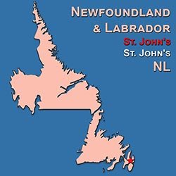 Newfoundland and Labrador brings together a large Atlantic island and an extensive mainland region, each with its own geography and character. Newfoundland's rocks preserve evidence of ancient oceans and colliding continents, spectacularly displayed at Gros Morne, where the Tablelands expose rock from Earth's mantle. Glaciers carved its valleys and dramatic coastal inlets, while headlands, offshore islands, bogs, and rocky barrens give much of the island an unmistakable appearance. Labrador is dominated by ancient Canadian Shield bedrock, enormous river systems, boreal forests, and northern tundra, with the Torngat Mountains rising above a deeply indented coast. Across both regions, the sea is a powerful presence, shaping settlement, travel, wildlife, and the view from countless communities.
Newfoundland's climate is strongly influenced by the North Atlantic, with cool summers, changeable weather, frequent wind, and fog along many coastal areas. The cold Labrador Current contributes to coastal conditions and carries icebergs southward during the seasonal iceberg passage. Winters vary considerably, with wet, stormy weather in some districts and heavy snow in others. Labrador generally has colder winters and greater seasonal temperature contrasts inland, while its northern coast has Arctic conditions and a brief summer. Weather can alter plans quickly, and the rhythms of sea ice, storms, fishing seasons, and long northern daylight remain important parts of life.
The province's history includes the Beothuk of Newfoundland and the continuing cultures of Mi'kmaq, Innu, Inuit, and other Indigenous communities, whose experiences differ across the island and mainland. Norse visitors established a settlement at L'Anse aux Meadows around a thousand years ago, long before the later European fisheries brought sustained colonial involvement. Fishing, especially for cod, shaped settlement and livelihoods for centuries, and Newfoundland joined Canada in 1949. English and Irish influences remain evident in speech, ballads, storytelling, and traditional music, while Labrador has its own rich Indigenous and settler traditions. Kitchen gatherings, sharp humour, distinctive local expressions, and a strong sense of community give the province a recognizable cultural voice, even as the consequences of the 1992 cod moratorium continue to shape its modern story.
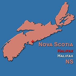
 Nova Scotia is a province shaped by the Atlantic, with a long mainland peninsula and Cape Breton Island surrounded by bays, straits, and open ocean. Its varied rocks record ancient continental collisions, volcanic activity, and sedimentary environments, while later glaciers created much of its lake-filled interior and irregular coastline. The Cape Breton Highlands rise above dramatic coastal roads and valleys, and the Annapolis Valley provides a sheltered agricultural landscape between uplands. Along the Bay of Fundy, tidal flats, fossil-bearing cliffs, and powerful tidal movements reveal a different coastal world from the granite headlands and fishing coves of the Atlantic shore. Although relatively compact, the province contains striking differences in scenery over short distances.
The surrounding ocean moderates Nova Scotia's climate, generally reducing temperature extremes compared with inland parts of Canada at similar latitudes. Summers are often pleasantly warm, though exposed Atlantic shores can remain cool and foggy, and inland valleys can become considerably hotter. Winters bring a changing mixture of snow, rain, freezing rain, and thaws, while elevated districts and parts of Cape Breton can receive substantial snowfall. Coastal storms are a recurring influence, and tropical systems sometimes reach the province in late summer or autumn. The growing season supports orchards, vineyards, and other farming in favourable areas, while the ocean's temperature and weather patterns shape fishing and coastal life.
Nova Scotia lies within Mi'kma'ki, the ancestral homeland of the Mi'kmaq, whose culture and treaty relationships remain fundamental to the province. Its later history includes Acadian settlement and deportation, British colonial expansion, Scottish and Irish immigration, and longstanding African Nova Scotian communities. One of Canada's founding provinces in 1867, it developed through fishing, shipbuilding, coal mining, agriculture, and the strategic importance of Halifax's harbour. Cape Breton's Gaelic heritage and fiddle traditions are internationally recognized, but the province's musical life also includes Acadian, Mi'kmaw, African Nova Scotian, and contemporary influences. Community gatherings, seafood traditions, historic waterfronts, and a lively arts scene connect its maritime past with a diverse modern identity.
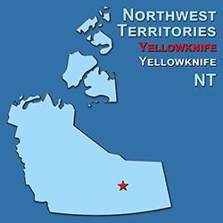
 The Northwest Territories extends from boreal forests and immense freshwater lakes to Arctic tundra, islands, and the Beaufort Sea. Its geology ranges from the ancient exposed rocks of the Canadian Shield in the east to sedimentary plains and the mountainous landscapes of the west. Great Slave Lake and Great Bear Lake are among its defining features, while the Mackenzie River, known as Deh Cho in some Dene languages, carries water northward through an enormous drainage basin. Glaciation shaped many lakes and valleys, and permafrost strongly influences soils, wetlands, and construction in colder regions. The territory encompasses far more than a single image of the North: forested river communities, rocky lake shores, mountain valleys, and Arctic coastal settlements each occupy different environments.
Climate varies from subarctic conditions across much of the territory to Arctic conditions farther north. Winters are long and cold, but inland southern areas can have surprisingly warm summer days, with extended daylight supporting an intense season of plant growth and outdoor activity. Above the Arctic Circle, the annual cycle includes periods of midnight sun and, in winter, periods when the sun remains below the horizon. Coastal areas have cooler summers than many inland districts, and sea ice is important to northern travel and harvesting. Winter darkness creates favourable opportunities to see the aurora, while changing ice conditions, thawing permafrost, and wildfire affect communities and the land.
Dene, Inuvialuit, Métis, and other Indigenous communities are central to the territory's history and contemporary identity. Longstanding travel and trading networks preceded European fur trading, missionary activity, and later mining and government expansion. The Northwest Territories became part of Canada in 1870, but its boundaries changed repeatedly as provinces and other territories were created; Nunavut separated from its eastern portion in 1999. Languages, oral histories, beadwork, sewing, music, and knowledge of the land remain important cultural foundations. Yellowknife brings together government, commerce, and a diverse population, while smaller communities sustain distinct traditions and relationships with their surrounding rivers, lakes, forests, and coastlines.
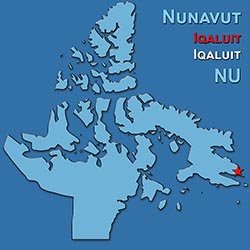 Nunavut is Canada's largest territory, extending across a vast mainland area and much of the Arctic Archipelago. Its landscapes include ancient Canadian Shield bedrock, broad tundra plains, sedimentary plateaus, and the dramatic mountains and ice caps of islands such as Baffin and Ellesmere. Glaciers have carved steep valleys and fjords, while permafrost shapes the ground beneath many communities and ecosystems. An enormous coastline connects settlements with marine environments that are central to travel, harvesting, and cultural life. What may appear empty on a distant map is a homeland filled with place names, travel routes, ecological knowledge, and histories carried across generations.
Nunavut's climate is predominantly Arctic, with long, very cold winters and short, cool summers, although conditions differ greatly between its southern mainland and far northern islands. Much of the territory receives relatively little precipitation, and parts of the High Arctic are often described as polar desert. Seasonal light is equally influential: communities above the Arctic Circle experience periods of continuous summer daylight and winter darkness, while those farther south still have dramatic changes in day length. Sea ice forms a seasonally important travel and harvesting environment rather than simply a barrier. Changes in ice, snow, and permafrost affect safety, wildlife, infrastructure, and the passing on of land-based knowledge.
Nunavut's history is rooted in successive Arctic peoples and especially in the enduring presence of Inuit, whose ancestors developed sophisticated ways of living within this environment. Whalers, traders, missionaries, and government interventions brought profound changes, including relocations and residential schooling that disrupted families and communities. Created on April 1, 1999, following decades of Inuit advocacy and a major land claims agreement, Nunavut represents an important achievement in political recognition and territorial governance. Its name means "our land" in Inuktitut, and Inuit languages, knowledge, and values remain central to its identity. Sculpture, printmaking, sewing, throat singing, film, and contemporary music express a culture that continues to evolve while sustaining strong relationships with family, community, and the land.
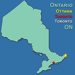 Ontario stretches from the Great Lakes and the St. Lawrence River to the shores of Hudson Bay and James Bay, encompassing much more than its heavily populated southern corridor. Ancient Canadian Shield rocks dominate much of the central and northern landscape, where glaciers left exposed bedrock, forested ridges, and countless lakes. Southern Ontario includes sedimentary lowlands and fertile glacial deposits, with the Niagara Escarpment forming a prominent ridge through the region. In the far north, the Hudson Bay Lowlands contain extensive wetlands and peatlands. The province's rivers and lakes have long served as transportation routes, and its freshwater geography remains central to industry, farming, recreation, and community life.
Ontario's climate changes substantially with latitude and proximity to the Great Lakes. Southern districts generally have warm, humid summers and cold winters, while the lakes moderate temperatures near their shores and create heavy lake-effect snowfall in certain areas. Sheltered locations support orchards, vineyards, and other crops that would be difficult to grow farther inland or north. Northern Ontario has longer, colder winters and shorter summers, with subarctic conditions near Hudson Bay. Autumn colour, spring maple sap, summer lake visits, and winter skating reflect seasonal patterns familiar to many residents, although the timing and intensity of those seasons vary considerably across the province.
Ontario encompasses the homelands of many Indigenous peoples, including Anishinaabe, Haudenosaunee, Cree, and other nations, alongside longstanding Métis communities. European trade and settlement, British colonial administration, immigration, and industrial development gradually transformed the region, which became a founding province of Canada in 1867. Ottawa serves as the national capital, while Toronto is a major centre of finance, media, and international cultural exchange. Ontario's identity includes francophone communities, northern resource towns, agricultural districts, and neighbourhoods shaped by immigration from around the world. Indigenous art, theatre, popular music, regional festivals, and diverse food traditions all contribute to a province whose cultural character is as varied as its geography.
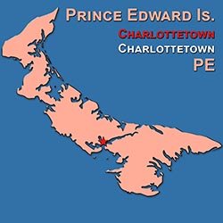 Prince Edward Island is Canada's smallest province, a gently rolling island in the Gulf of St. Lawrence where farmland, small communities, and the sea are rarely far apart. Its characteristic red soil and cliffs come from iron-bearing sedimentary rocks, particularly sandstone, whose colouring becomes especially vivid against green fields and blue water. Glaciers and later coastal processes helped shape the island's low hills, bays, estuaries, dunes, and beaches. Unlike Canada's rugged mountain regions, much of its beauty lies in softer contours and the close relationship between cultivated land and shoreline. Its relatively soft coastal materials also make erosion a natural and persistent part of the changing landscape.
The surrounding gulf moderates the island's climate, bringing warm summers, cold winters, and seasonal weather that depends partly on water temperatures and sea ice. Spring often arrives slowly because nearby waters remain cold, while autumn warmth can linger after inland regions begin cooling. Winter is no gentle exception: snowstorms, strong winds, and drifting snow can be significant, despite the island's maritime setting. Summer supports farming, fishing, beach visits, and a busy tourism season, with long evenings adding to the island's relaxed atmosphere. Coastal storms and erosion are important realities for communities whose livelihoods and sense of place are closely tied to the shore.
The island is known to the Mi'kmaq as Epekwitk, and its Indigenous history long predates French and British settlement. Acadian communities, Scottish and Irish immigrants, and later newcomers helped shape its society, while disputes over absentee landownership became a defining political issue. Charlottetown hosted the 1864 conference that helped set Confederation in motion, although Prince Edward Island itself did not join Canada until 1873. Farming and fishing remain powerful cultural anchors, alongside fiddle music, community theatre, and traditions of gathering around food and conversation. Lucy Maud Montgomery's Anne of Green Gables brought international attention to the island, but its character also lives in everyday working landscapes, Acadian celebrations, Mi'kmaw culture, and the enduring connections of small communities.
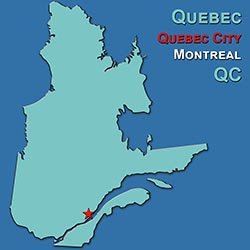 Quebec is Canada's largest province by area, extending from the fertile St. Lawrence Lowlands to the forests, tundra, and Arctic shores of the far north. Much of its territory lies on the ancient Canadian Shield, where exposed bedrock, glacially shaped lakes, and broad river systems define the landscape. South of the St. Lawrence, the Appalachians bring another geological character, especially in the Eastern Townships and Gaspé Peninsula. The St. Lawrence River and its estuary form the province's great settlement and transportation corridor, connecting inland waters with the Atlantic. From Laurentian hills and agricultural plains to northern hydroelectric watersheds and coastal cliffs, Quebec contains an extraordinary range of environments.
Quebec's climate ranges from humid continental conditions in the populous south to subarctic and Arctic conditions in the north. Southern summers can be warm and humid, while winters are cold and often snowy, supporting a deeply established culture of winter recreation and seasonal celebration. The St. Lawrence estuary and gulf influence coastal weather, creating cooler summers and different snowfall patterns from those inland. Farther north, the growing season becomes brief, and permafrost and sea ice are important features of the environment. Maple sugaring, autumn colour, summer festivals, and winter carnivals mark the southern calendar, while northern communities experience a different rhythm shaped by light, snow, ice, and wildlife.
Quebec is home to distinct Indigenous nations, including Cree, Inuit, Innu, Anishinaabe, Kanien'kehá:ka, and others whose languages and territories are integral to its history. French colonization along the St. Lawrence established the foundations of a francophone society that endured British conquest and became part of Confederation in 1867. The twentieth-century Quiet Revolution transformed education, government, religion's public role, and debates over national identity. French remains central to public life, supported by a rich tradition of literature, chanson, cinema, theatre, and political discussion. Montréal's diverse neighbourhoods, Québec City's historic streets, rural traditions, Indigenous cultural life, and regional foods together make Quebec far more varied than any single cultural image suggests.
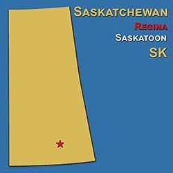 Saskatchewan is often pictured as an endless prairie beneath a wide sky, but its geography also includes rolling uplands, river valleys, sand dunes, northern forests, and thousands of lakes. Southern and central areas rest largely on sedimentary rocks covered by glacial deposits, while ancient Canadian Shield bedrock emerges across the north. Ice sheets and meltwater shaped the plains, leaving fertile soils in some districts and a patchwork of wetlands and depressions in others. Buried geological deposits support important potash, oil, and other resource industries. The North and South Saskatchewan rivers are major features of a province whose apparent openness conceals considerable geological and ecological variety.
Saskatchewan has a strongly continental climate, with large differences between summer and winter temperatures. Southern districts are generally relatively dry and sunny, making moisture availability a central concern for farming and native grasslands. Summer can bring heat, powerful thunderstorms, and hail, while winter brings severe cold, wind, and blowing snow across exposed terrain. Conditions become cooler and the growing season shorter toward the forested north, although long summer daylight supports a concentrated season of growth. The prairie sky is more than a scenic backdrop: watching clouds, wind, and approaching weather has long been part of working and living on the land.
The region is part of the homelands of Cree, Dakota, Lakota, Nakota, Dene, Saulteaux, and Métis peoples, whose histories connect prairie, parkland, and northern environments. The fur trade, the destruction of bison populations, treaties, the North-West Resistance of 1885, and agricultural settlement profoundly changed those relationships with the land. Saskatchewan became a province in 1905, and farming communities later played important roles in cooperative movements and the development of publicly funded medical care. Its culture reflects Indigenous languages and arts, Métis music, immigrant farming traditions, and the literary and visual inspiration of the prairie landscape. Regina and Saskatoon support lively contemporary arts scenes, while smaller communities sustain local festivals, curling, agricultural gatherings, and strong traditions of mutual assistance.
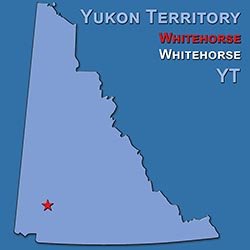 Yukon is a mountainous northwestern territory of great river valleys, boreal forest, alpine tundra, and immense glaciated ranges. The Saint Elias Mountains in the southwest contain Mount Logan, Canada's highest mountain, along with extensive icefields and glaciers. Elsewhere, its geology reflects ancient continental fragments, mountain building, and mineral-rich formations, while the Yukon River and its tributaries provide major geographic corridors. Parts of the territory belonged to Beringia, a broad region that remained free of continental ice during much of the last ice age and supported distinctive plants and animals. This combination of glaciated mountains and unglaciated landscapes makes Yukon especially important for understanding northern natural history.
Much of Yukon has a subarctic climate, with long, cold winters and short summers that can be surprisingly warm in inland valleys. Mountains create strong local differences in temperature and precipitation, and many interior areas are relatively dry because they lie beyond coastal moisture barriers. Summer days are very long, with midnight sun in the far north, while winter brings limited daylight and frequent opportunities to observe the aurora under clear skies. Elevation, latitude, and proximity to large icefields all influence local conditions. The seasonal transition can be dramatic, with spring breakup, bright summer growth, autumn colour, and winter snow each changing how people travel and use the land.
Yukon's history begins with First Nations whose trading networks, languages, and knowledge of the land long preceded newcomers; these include Gwich'in, Hän, Tutchone, Kaska, Tagish, Tlingit, and other peoples. The Klondike Gold Rush, following the 1896 discovery of gold, brought a sudden influx of prospectors and led to Yukon's creation as a separate territory in 1898. Later, construction of the Alaska Highway during the Second World War reshaped transportation and connections with the wider continent. Today, First Nations governments and cultural renewal are central to territorial life, alongside mining, tourism, and a vigorous arts community. Whitehorse and Dawson City offer different expressions of that identity, combining contemporary music and storytelling with northern traditions and a complicated gold-rush legacy.